
Jordan and Holy Land | Jordan & Holy Land
Description
Jordan and Holy Land | Jordan & Holy Land
Itinerary
DAY 01: Arrive Sharm EL sheik, meet and assist upon arrival, transfer to hotel for overnight.
DAY 02: Transfer from Nuweiba board by speed boat to Akkaba and visit (Wadi Rum) and (Petra).
Wadi Rum is known as The Valley of the Moon, also a valley cut into the sandstone and granite rock in south Jordan at 60 km to the east of Aqaba. It is the largest wadi in Jordan. The name Rum most likely comes from an Aramaic root meaning 'high' or 'elevated'. To reflect its proper Arabic pronunciation, archaeologists transcribe it as Wadi Ramm. The highest elevation in Wadi Rum is Mount Um Dami at more than 1800m above sea level Wadi Rum has been inhabited by many human cultures since prehistoric times, with many cultures–including the Nabateans– leaving their mark in the form of rock paintings, graffiti, and temples. As of 2007, several Bedouin tribes inhabit Rum and the surrounding area. In the West, Wadi Rum may be best known for its connection with British officer T. E. Lawrence, who based his operations here during the Arab Revolt of 1917–18. In the 1980s one of the impressive rock formations in Wadi Rum was named "The Seven Pillars of Wisdom" in memory of Lawrence's book penned in the aftermath of the war, though the 'Seven Pillars' referred to in the book actually have no connection with Rum.
Petra is a historical and archaeological city in the Jordanian governorate of Ma'an that is known for its rock cut architecture and water conduits system. Established sometime around the 6th century BC as the capital city of the Nabataeans,[2] it is a symbol of Jordan as well as its most visited tourism attraction. It lies on the slope of Mount Hor[3] in a basin among the mountains which form the eastern flank of Arabah (Wadi Araba), the large valley running from the Dead Sea to the Gulf of Aqaba. Petra has been a UNESCO World Heritage Site since 1985. The site remained unknown to the Western world until 1812, when it was introduced by Swiss explorer Johann Ludwig Burckhardt. It was described as "a rose-red city half as old as time" in a Newdigate Prize-winning sonnet by John William Burgon. UNESCO has described it as "one of the most precious cultural properties of man's cultural heritage."] Petra was chosen by the BBC as one of "the 40 places you have to see before you die.
DAY 03: Petra (Sightseeing) – Travel to Amman
DAY 04: Visit Jabbok – Jerasa – Um Qais – Pella – Amman
Jabbok,The headwaters of the Jabbok begin in Amman (ancient Rabbathammon) and the river flows to the north before heading west to the Jordan River. Though not explicitly stated, it seems likely that Abraham passed this way along the Jabbok River as he traveled from Haran to Shechem (later Jacob would travel on this route). In almost any reconstruction of Jacob's journey back to the Promised Land, he traveled down this valley pictured at right. Scholars debate the locations of Penuel and Mahanaim (see below), but everyone locates these sites somewhere in connection with this river. The natural terrain of this part of the valley would suggest that Jacob traveled on the south (right) side of the river at this point.
Jerash, located 48 km north of Amman and nestled in a quiet valley among the mountains of Gilead, is the grandeur of Imperial Rome being one of the largest and most well preserved sites of Roman architecture in the World outside Italy. To this day, its paved and colonnaded streets, soaring hilltop temples, handsome theaters, spacious public squares and plazas, baths, fountains and city walls pierced by towers and gates remain in exceptional condition. This fascinating city makes a great day-trip from Amman, particularly in spring, when the wildflowers are in bloom. The drive will take you less than an hour, but will transport you 2000 years back in time. Within the remaining city walls, archeologists have found the ruins of settlements dating back to the Neolithic Age, indicating human occupation of this location for more than 6500 years.
Um Qais situated 110 km north of Amman on a broad promontory 378 meters above sea level with a magnificent view over the Yarmouk River, the Golan Heights, and Lake Tiberias, this town was known as Gadara, one of the most brilliant ancient Greco-Roman cities of the Decapolis; and according to the Bible, the spot where Jesus (pbuh) cast out the Devil from two demoniacs (mad men) into a herd of pigs (Mathew 8:28-34). In ancient times, Gadara was strategically situated, laced by a number of key trading routes connecting Syria and Palestine. It was blessed with fertile soil and abundant rainwater. This town also flourished intellectually in the reign of Augustus and became distinguished for its cosmopolitan atmosphere, university's scholars, attracting writers, artists, philosophers and poets, the likes of satirist Menippos (2nd half of the 3rd century BC), the epigrammist Meleagros, and the rhetorician Theodoros (14-37 AD). Gadara was also the resort of choice for Romans vacationing in the nearby Himmet Gader Springs. Archaeological surveys indicate that Gadara was occupied as early as the 7th century BC. The Greek historian, Polybius, described the region as being under Ptolemaic control at the time. The Seleucid ruler Antiochus III conquered it in 218 BC, naming the city Antiochia and Seleucia. In 63 BC, Pompey liberated Gadara and joined it to the Roman league of ten cities, the Decapolis. Magnificently set in a fold of the hills that rise from the Jordan Valley 78 km north of Amman.
Pella, known in Arabic as Tabaqat Fahl; is one of the most ancient sites in Jordan and a favorite of archaeologists being exceptionally rich in antiquities. It is perfectly situated, for there is a spring here which issues into a small river and never runs dry. The tell itself seems to have been continuously occupied since Neolithic times for some flints from this period have been found there; and some recent finds 2 km north of the tell even date to Paleolithic times, around 100,000 years ago. Excavations by a team of Australian archaeologists have revealed much in the decade they have been working here, but still more remains hidden. Besides the excavated ruins from the Greco- Roman period, including an Odeon (theater) built in a curve of the hillside, Pella offers visitors the opportunity to see several artifacts of a Chalcolithic settlement from the 4th millennium BC, the remains of Bronze and Iron Ages walled cities, Byzantine churches and houses, an Early Islamic residential quarter, and a small medieval mosque.
DAY 05: Visit Madaba – Berg Nebo – Bethanien -- Qumran (ÜN)
Madaba, The trip south from Amman along the 5000-year-old King's Highway is one of the most memorable journeys in the Holy Land, passing through a string of ancient sites. The first city you come upon is Madaba, "The City of Mosaics". In many respects Madaba is a typical East Bank town which differs in one major aspect: underneath almost every house lies a fine Byzantine mosaic. Many of these mosaics have been excavated and are on display in the town's museum, but it is estimated that many more lie hidden waiting to be discovered. Madaba's chief attraction - in the contemporary Greek Orthodox church of St. George - is a wonderfully vivid, 6th-century Byzantine mosaic map showing the entire region from Jordan and Palestine in the north, to Egypt in the south.
Mount Nebo, Drive along the same route prophet Moses (pbuh) was forbidden to travel on by the King of Edom (Numbers 20), and picture yourself standing where Moses was laid to rest, and where the late Pope John Paul II tread on his first pilgrimage of the millennium. Visit the Sanctuary at Nebo: the memorial of Moses (pbuh), the presumed site of his death and burial place, and a center for pilgrimages since earliest Christian times. You'll be inspired by the biblical feel from start to finish as you experience this divine tour. Mount Nebo is one of the most revered holy sites of Jordan; located 10 km west of the Roman Byzantine town of Madaba, for this is where Moses (pbuh) was buried. The site's association with the last days of Moses is described in moving words in Deuteromony. The episode of Balak and Balam also took place here.
Bethanien, When the first German settlers arrived in the area in 18 64, they found that the aboriginal people called the area Kara Kara. However, the German settlers named the locality Bethanien, which was the German spelling of the Palestinian town of Bethany. When the railway line came through the area, the Railway Department proposed that the station be called 'Kara Kara'. The German settlers protested and requested that Bethanien be retained. Bethania - the Latin spelling of Bethanien was the compromise. In 1985 the name Eden's Landing was officially given to a new suburb situated on the southern bank of the Logan River between Waterford and Beenleigh. The new suburb was comprised of parts of the existing suburbs of Holmview and Bethania. Leighton Properties marketed the new residential development with a name which linked the development back to the 1860s. A pioneer hotelier and ferryman Henry Eden operated a ferry punt at Waterford - at a site somewhat upstream from the future residential development. In the 1870s, Henry Eden moved to the Tweed River where he built a small cedar home, 'Ostia', at the future site of Coolangatta. Eden also operated a chartering service, transporting cedar between Brisbane and the Northern Rivers District of New South Wales. He also took a land selection the "Garden of Eden" in the Currumbin District. Finally he returned to England to claim a hereditary title of Viscount Eden .
Qumran, the place where they discovered the Dead Sea Scrolls.
DAY 06: Qumran (Sightseeing) – Jericho – Jordantal – See Genezareth (En Gev)
Jericho, The southern side of the Jordan River, before it flows into the Dead Sea, is the Jericho section. At this location, on the border between Israel and Jordan, are a number of points of interest: the traditional site of the crossing of the Jordan by the Israelites, the departure of Elijah on a chariot of fire, the pilgrimage site of John's baptize of Jesus, and many monasteries and chapels of various Christian orders.
Gordan Vally, The Jordan Valley is a low-lying strip which cleaves down the western border of the country. It is part of the Great Rift Valley, which extends down southwards into East Africa. The Jordan Valley is divided into several distinct geographic sub-regions. Its northern part is known as the Ghor, and it includes the Jordan River. Several degrees warmer than the rest of the country, its year-round agricultural climate, fertile soils and water supply have made the Ghor the food bowl of Jordan. The Jordan River rises from several sources, mainly the Anti-Lebanon Mountains in Syria, and flows down into Lake Tiberias (the Sea of Galilee), 212 meters below sea level. It then drains into the Dead Sea which, at 400 meters below sea level, is the lowest point on earth. South of the Dead Sea, the Jordan Valley turns into the hot, dry Wadi ‘Araba, the "wilderness" or "Arabah desert" of the Bible.
See Genezareth, The lake is with 212 m under the sea level the tiefstgelegene fresh water lake of the earth; other fresh water lakes are however substantially deeper (see above all: Baikalsee).It actual depending upon water level - up to 21 km long, in its broadest place 12 km broad, its water surface amounts to 165 km ², its extent 53 km and in the deepest place measures it 46 M. After the Dead Sea (approx. 400 m under NN) is it zweittiefst lying standing waters of the earth.
DAY 07: Praying Time and Swim and Gemeinschaft and picnic.
DAY 08: Schiffahrt See Genezareth - Tabgah – Kapernaum - Banyas – Rückfahrt über Golan
Tabgha (also spelled Tabhka) is not a city, but a small area on the northwest shore of the Sea of Galilee, not far from Capernaum. In ancient times, Tabgha was known as Heptapegon - "Place of the Seven Springs." These seven springs produce warm water, which increases the production of algae in this part of the lake, which attracts more fish. Fisherman have thus flocked to Heptapegon for thousands of years. By the 4th century AD, Heptapegon had become a popular place for Byzantine pilgrims to rest and have their picnics, thanks to its shady trees and excellent fishing.
Capernaum, Aside from various references to Capernaum in the Gospels, the earliest literary attestation of Capernaum is from Josephus, who refers to the village in connection with a fertile spring. The Jewish historian reports he spent a night there with a fever during the second year of the Jewish War. For centuries, Capernaum has traditionally been identified as a site located on the northwestern shore of the Sea of Galilee, about three miles west of the upper Jordan River. In 1838, Edward Robinson correctly identified there the remains of a synagogue that was partly excavated by Charles Wilson between 1865 and 1866. More extensive excavations took place in the early twentieth century, first by Heinrich Kohl and Carl Watzinger (1905) and then by Wendelin von Menden (1906–1915). In 1921, the synagogue was partially restored by Gaudenzio Orfali. In more recent times, Virgilio Corbo and Stanislao Loffreda conducted nineteen seasons at Capernaum between 1968 and 1986, excavating not only the synagogue, but also a nearby church that had long been associated with the house of St. Peter. Most recent excavations have revealed two synagogues, a white limestone synagogue dating from the fourth to fifth centuries CE, and a black basalt synagogue dating from the first half of the first century CE. Only foundation walls, gray marble column fragments and a cobblestone floor remain from the earlier structure, which measured 24.5 by 18.7 meters on the exterior and possessed walls over a meter thick.
Banyas, The Banyas Nature Reserve, also called Nahal Hermon Reserve, encompasses the upper Nahal Hermon, the Banyas waterfall and a number of archaeological sites, including remains of a Greek temple dedicated to the goat-footed god Pan. The trails in the reserve pass along bubbling springs, brooks and waterfalls, in the midst of thick riverbank vegetation, and the reserve gives a pleasant refuge from the sun even in summer.
DAY 09: Visit Kana – Nazareth – Megiddo – Safed - Berg Tabor – Berg Karmel – ÜN am Mittelmeer
Megiddo, (meGIDo), or Tel Megiddo (TEL-meGIDo), an ancient fortified city, is one of the most famous battlegrounds in the world. Historians believe that more battles were fought at this location than anywhere else on earth. "When Edwin Robinson stood on the imposing hill known as Tell el-Mutesellim in 1838, he jotted down in his diary the words, 'I wonder where Megiddo could have been.' Ironically, the mound on which he was standing, rising seventy feet above the surrounding plain and occupying an area of ten acres on its summit (with lower levels even larger) soon proved to be the site of Megiddo" (Pfeiffer, 1966: 375).
Safed, A rather small town located in Northern Israel, 900 meters (3200 feet) above sea level in the mountains of the Upper Galilee, it commands magnificent views east to the Golan, north to the Hermon and Lebanon, west to Mt. Meron and the Amud Valley, and south to Tiberias and the Kinneret (Sea of Galilee). For a long time Safed has been a well kept secret, even to most Israelis. However, according to the great mystics of the past, Safed is to play an important role in the final redemption. The Meam Loez, in the name of Rabbi Shimon bar Yochai, says that the Messiah will come from Safed on his way to Jerusalem. The Ari HaKodesh said that until the Third Temple is built, the Shechinah (God's Manifest Presence) rests above Safed Mount Tabor Mount Tabor (Hebrew: Har Tavor) is a hill rising 500m above the Jezreel Valley in the region of Galilee. Due to its strategic location along the northsouth road, it has been an important fortress since ancient times. Christians have identified a rock atop Mt. Tabor as the place of the Transfiguration of Christ since the 4th century AD.
Mount Carmel, Mt. Carmel was most significant in ancient times as a barrier to traffic along the coastal plain. The 1500-foot high limestone mountain impeded armies and merchants traveling to the Jezreel Valley. Mt. Carmel is referenced most often as a symbol of beauty and fertility. To be given the "splendor of Carmel" was to be blessed indeed (Isa 35:2). Solomon praised his beloved: "your head crowns you like Mount Carmel" (Song 7:5). But for Carmel to wither was a sign of devastating judgment.
DAY 10: Visit Cäsarea – Tel Aviv – Jaffa - Beit Guvrin – Tel Maresha – Jerusalem
Caesarea, is a town in Israel on the outskirts of Caesarea Maritima, the ancient port city. It is located mid-way between Tel Aviv and Haifa (45 km), on the Israeli Mediterranean coast near the city of Hadera. Modern Caesarea as of December 2007 has a population of 4,500 people It is the only Israeli locality managed by a private organization, the Caesarea Development Corporation, and also one of the most populous localities not recognized as a local council.
Jaffa, The name of the city is supposedly mentioned in Egyptian sources and the Amarna Letters as Yapu. There are several legends about the origin of the name Jaffa. Some say it is named for Japheth, one of the sons of Noah, who built it after the Great Flood The Hellenist tradition links the name to "Iopeia", which is Cassiopeia, the mother of Andromeda. An outcropping of rocks near the harbor is reputed to have been the place from which Andromeda was rescued by Perseus. Pliny the Elder associates the name with Jopa, the daughter of Aeolus, god of wind. The Arab geographer Al-Muqaddasi mentions it under the name Yaffa, which is used by Arabic speakers today.
Bet Guvrin, Bet Guvrin, south of Beth Shemesh, is just one of these amazing places in Israel. Recently a 1700-year-old menorah was found in the vicinity. Some areas are yet unexcavated but they possibly contain more treasures from the Byzantine era; the most beautiful mosaic floors were brought to the Israel Museum in Jerusalem. In the early spring the national park in the Judean hills is a feast of flowers.
Maresha, Maresha was one of the cities of Judea during the time of the First Temple and is mentioned among the conquests of the ancient Israelites in the Book of Joshua and later in the Books of Chronicles as one of King Rehoboam's fortifications. In the 6th century BCE, as result of Zedekiah's rebellion against the Babylonian kingdom and its king Nebuchadnezzar II, the latter occupied the Judean kingdom and sent many of its inhabitants into exile. This marked the end of Maresha as a Jewish (or Judean) city.
Jerusalem, Located in the Judean Mountains, between the Mediterranean Sea and the northern edge of the Dead Sea, modern Jerusalem has grown far beyond the boundaries of the Old City.
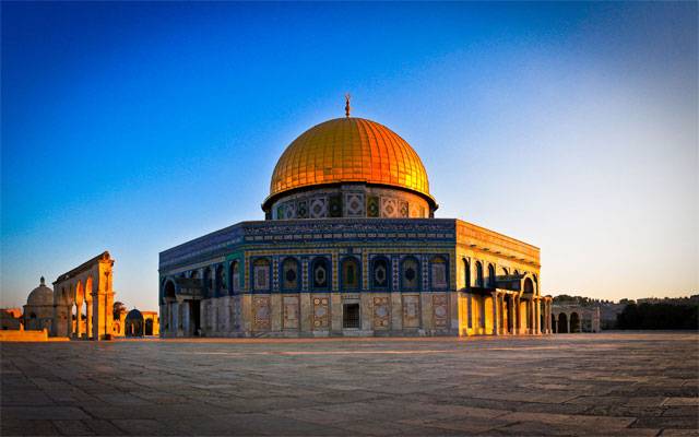
DAY 11: Jerusalem (Klagemauer, El Aksa, Felsendom, Schrein des Buches, Bethlehem, Ein Kerem
El-Aksa, Built by the Caliph al-Walid (r. 705-715), of the Umayyad dynasty, El-Aksa is one of the largest and most important mosques in the Muslim world, and the earliest in Palestine. Its construction was probably the architectural expression of the destination of Muhammad's Night Journey and of the place where his ascension to heaven occurred. The mosque was beautiful and vast twice the size of today's structure. The original mosque was destroyed in an earthquake in the middle of the eighth century and restored by the Abassids toward the end of that century. Other than a few pieces of wood bearing carvings of floral images, nothing remains of the decorations of the original mosque. Most of those in today's mosque date from medieval times.
Wailing Wall, The Western Wall is located in the Old City of Jerusalem at the foot of the western side of the Temple Mount. It is a remnant of the ancient wall that surrounded the Jewish Temple's courtyard, and is one of the most sacred sites in Judaism outside of the Temple Mount itself. Just over half the wall, including its 17 courses located below street level, dates from the end of the Second Temple period, having been constructed around 19 BCE by Herod the Great. The remaining layers were added from the 7th century onwards. The Western Wall refers not only to the exposed section facing a large plaza in the Jewish Quarter, but also to the sections concealed behind structures running along the whole length of the Temple Mount, such as the Little Western Wall–a 25 ft (8 m) section in the Muslim Quarter.
Bethlehem, is a Palestinian city in the central West Bank, approximately 8 kilometers (5 mi) south of Jerusalem, with a population of about 30,000 people. It is the capital of the Bethlehem Governorate of the Palestinian National Authority and a hub of Palestinian culture and tourism. The Hebrew Bible identifies Beit Lehem as the city David was from and the location where he was crowned as the king of Israel. The New Testament Gospels of Matthew and Luke identify Bethlehem as the birthplace of Jesus of Nazareth. The town is inhabited by one of the oldest Christian communities in the world, though the size of the community has shrunk due to emigration.
Ein Kerem, is an ancient village which is now a neighbourhood in southwest Jerusalem, Israel. According to Christian tradition, John the Baptist was born in Ein Kerem, leading to the establishment of many churches and monasteries. In 2010, the neighborhood had a population of 2,000. It attracts three million visitors a year, one-third of them pilgrims from around the world.